Drone Training Workshop in Belize City
Coastal Zone Management Authority and Institute and the University of Central FloridaWritten by: Lain Graham (UCF), Andria Rosado and Jessamyn Ramos (CZMAI)On January 10th, 2018 Coastal Zone Management Authority and Institute (CZMAI) in collaboration with Citizen Science GIS at University of Central Florida (UCF) and with support from the Marine Conservation and Climate Adaptation Project (MCCAP) hosted a Drone Training workshop in Belize City.As drones gain recreational and professional popularity, regulations and restrictions are proving to be critical to ensure safe and effective drone operation. The training brought together 30 participants, representing 15 government, non-government and private sector agencies from across Belize. Agencies such as the Belize Civil Aviation, CZMAI, WWF- Belize, The Belize Port Authority, The University of Belize, The Department of the Environment, The Fisheries Department, The Belize City Council, The Lands Information Centre and Total Business Solutions Ltd were present. Participants not only learned how to operate drones safely and to be in compliance with emergent regulations, they also engaged in a conversation about the applications for drone technology in their industries. They also received hands-on-training with DJI Phantom 4 drones to put theory into practice.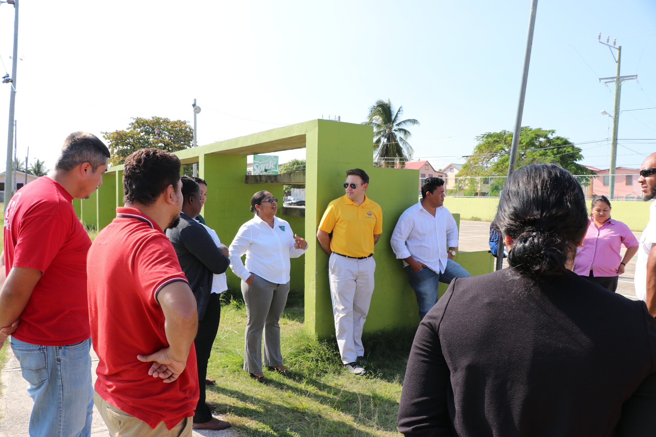 CZMAI’s Director, Arlene Young talked about the importance of these types of national and international partnerships, coming together to not only to learn about drone technology but to ‘talk’ across organizations. Collaboration means that we can accomplish more together by not duplicating efforts and by acting as players on a bigger team.This training was held jointly with representatives from Citizen Science GIS at the University of Central Florida, Assistant Professor of GIS, Dr. Timothy Hawthorne. Dr. Hawthorne has been working in Belize since 2011 and shared lessons learned from his Citizen Science GIS research, and his Open Reef drone mapping work. He was joined by his team, Ph.D. student, Lain Graham and M.A. student Nicholas Altizer, studying Sociology and GIS under Dr. Hawthorne, and Christine Munisteri, who graduated from Skidmore College with a BS in Environmental Studies.Before the training, the Open Reef team was featured on one of Belize’s national morning show, Open Your Eyes, to talk about the applications of drone technology and the training event with CZMAI.[embed]http://https://youtu.be/MfjsaJbQEv8[/embed]Dr. Hawthorne talked about the challenges of working with satellite imagery in Belize. The clarity of the publicly available data is insufficient to map key features on the island such as structures, docks, and seawalls that contribute to our understanding of human development and resiliency. Environmental changes are also impossible to monitor with the current satellite imagery, in addition to images of low resolution, the satellite data is also out of date, in some cases 10-15 years old, making it impossible to monitor things like sea level rise, adaptation, restoration or understand the effects of a natural disaster event on the cayes.
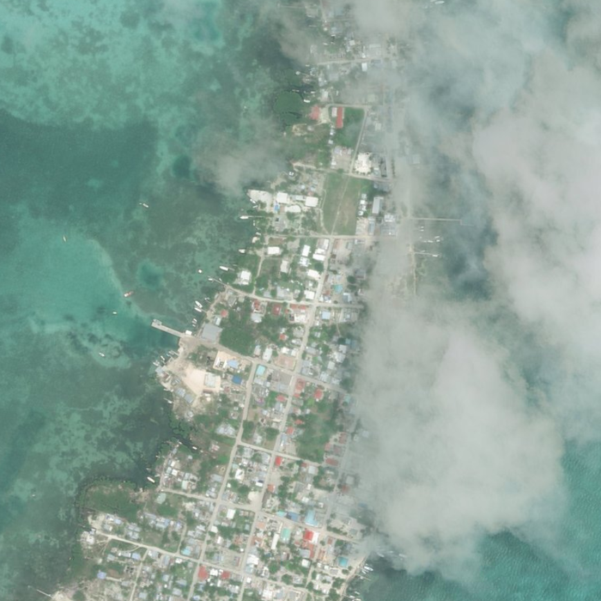
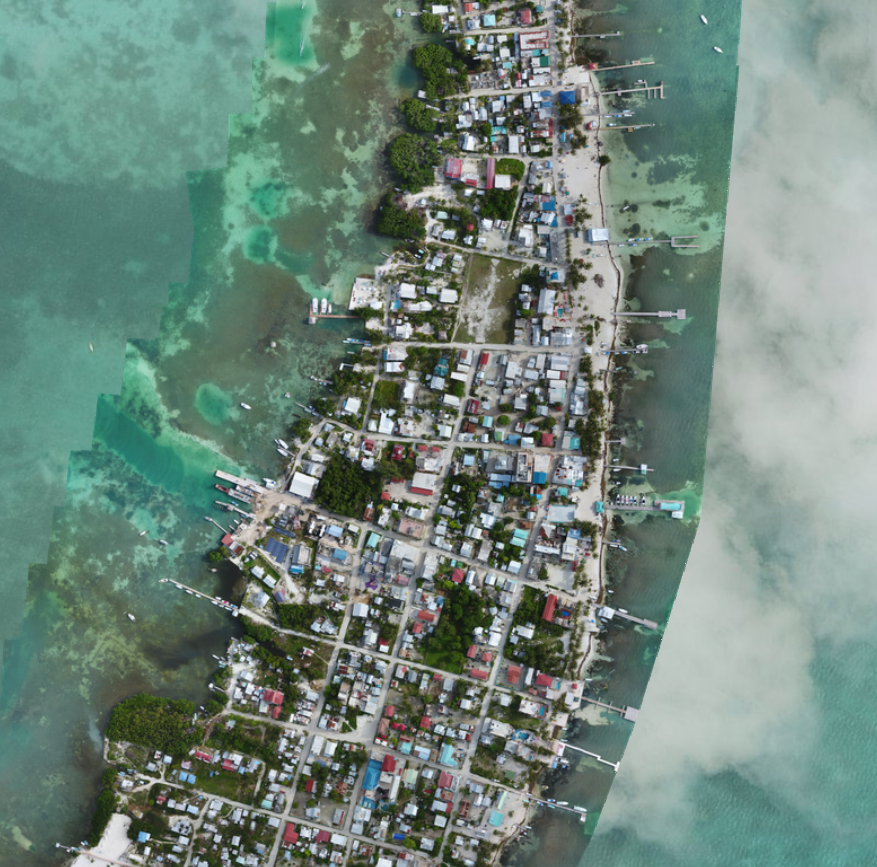 The most recent freely available satellite imagery of Caye Caulker on the left, illustrating cloud cover as a challenge with satellite imagery. Open Reef drone imagery on the right showing the features of the landscape and highlighting the clarity of the imagery compared to satellite imagery.Open Reef, an initiative of Citizen Science GIS in partnership with Coastal Zone and the University of Belize, has a mission to drone map every island in the Belize Barrier Reef and to share the data openly with the public, researchers and the people of Belize. Much like the core mission of the Open Reef and umbrella organization Citizen Science GIS, this drone training session was intended to be shared, collaborative and engaging.
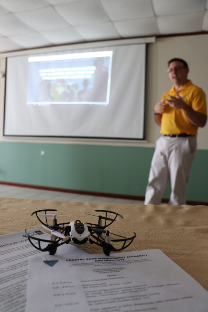 After a discussion about broader applications and impacts of drone technology, Nicholas Altizer from UCF and Open Reef led a session in flight planning, processing and digitizing. This session covered the basics of autonomous flight planning using DJI GS Pro, the appropriate settings to use for ideal front and side overlap and other settings that have helped the Open Reef team produce high-quality products. Hundreds of drone images from each flight are processed into one cohesive image called an orthomosaic, this 2D image is produced using Drone2Map software. Open Reef’s methodology has been crafted from a little over a year and a half of experience and has been specifically tailored to meet the research goals. The manual shared by Open Reef can be applied by a number of organizations that have similar mapping goals, with the understanding that customization for an agency’s needs and even each individual fight will vary.After lunch, the training took flight, in a hands-on session at the ”Yarborough Greens” in Belize City. Open Reef’s Nicholas Altizer, Lain Graham, and Christine Munisteri spent time training with each of the participants, using DJI Phantom 4 Pro drones, the staff illustrated how to flight plan, set up and safely fly the drones.
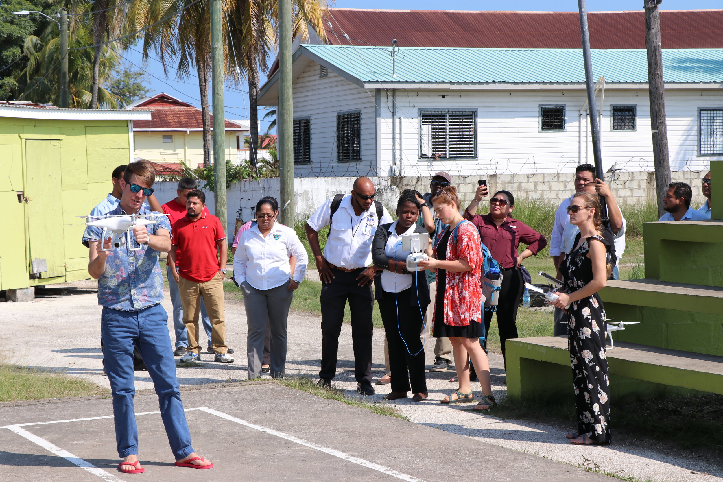 The Open Reef and CZMAI training was featured in the evening news on Channel 5 Belize. Find the full segment in the link below.[embed]http://https://youtu.be/tf_oeBGeXYg[/embed]The hosting organizations’ hope for this training is that it not only engaged people with technology but more importantly connected “people with people”. There is power in collaboration when ideas are shared, people develop effective and innovative solutions to their problems.
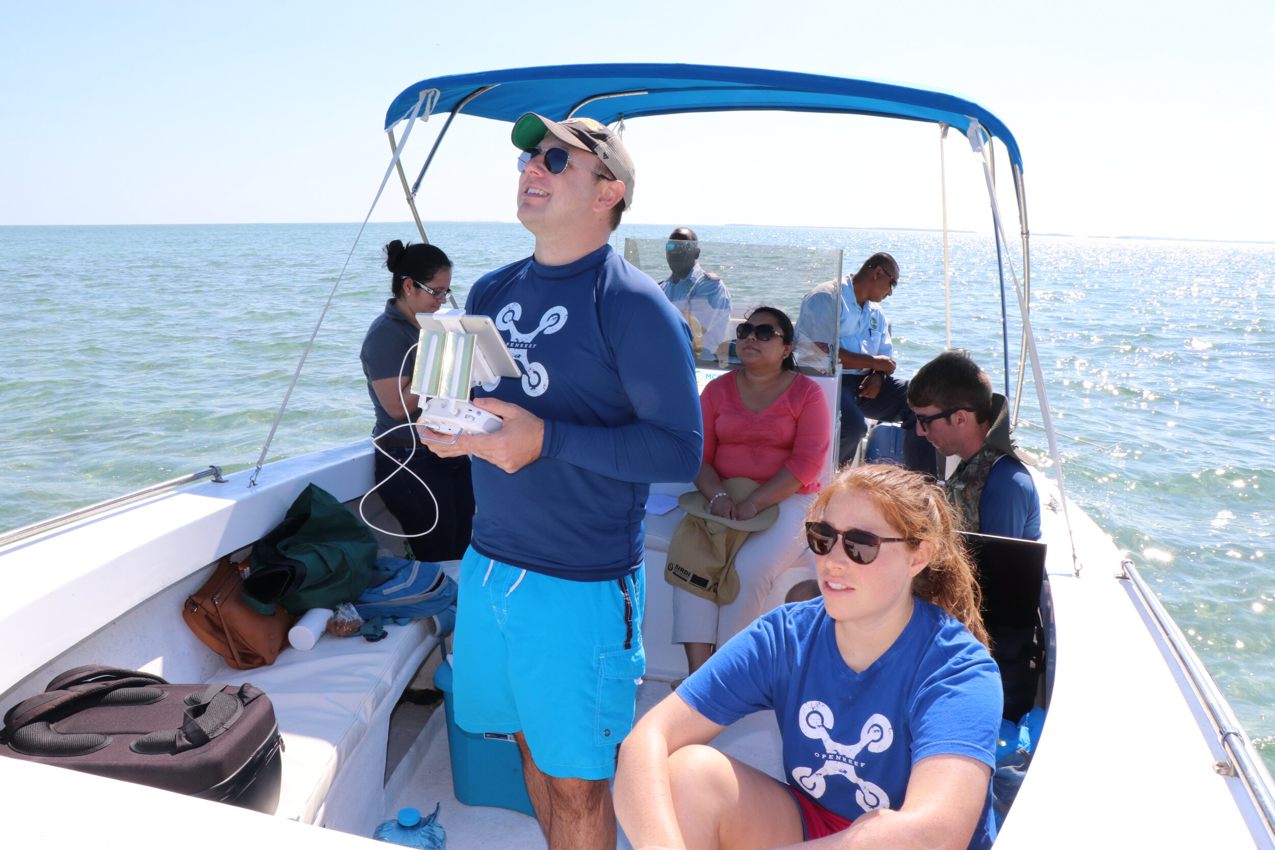 Coastal Zone Management Authority and Institute, Citizen Science GIS and Open Reef hope that their collaborative drone mapping work on the cayes will ignite national and international interest in these treasured ecological, cultural and economic resources. Consequently, this initiative can work towards sustainable solutions to ensure they are there for generations to come.To learn more about the work of Citizen Science GIS and Open Reef in Belize, please visit: www.citizensciencegis.org or on Facebook at www.facebook.com/citizensciencegis. There are partnership opportunities available to expand this work in Belize and around the world.About Citizen Science GIS: Citizen Science GIS is an organization at the University of Central Florida, a 2017 Esri Special Achievement in GIS Awardee, and has a mission to change the way communities and scientists work together across the globe to visualize local knowledge through geographic information systems, maps, apps, and drones.
